

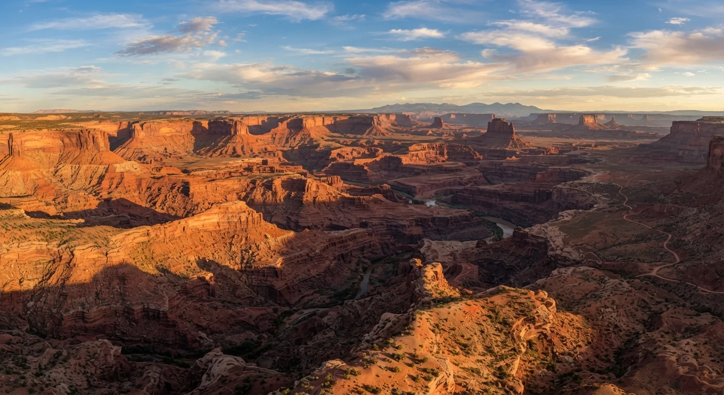
What Defines the American Southwest
The American Southwest resists easy definition, but the region generally encompasses Arizona, Utah, New Mexico, Nevada, and parts of Colorado and California. What unites these states is a shared landscape grammar: high desert plateaus, sculpted canyon systems, sparse vegetation adapted to aridity, and skies that seem to exist on a different scale than anywhere else in the country.
Four distinct desert ecosystems overlap here — the Mojave, the Sonoran, the Chihuahuan, and the Great Basin — each with its own elevation profile, rainfall pattern, and flora. The Sonoran Desert, which blankets much of southern Arizona and northern Mexico, is the only place on Earth where the iconic saguaro cactus grows wild. The Colorado Plateau, a raised tableland roughly the size of France, anchors the canyon country that most visitors picture when they think of this region.
277 miles
Length of Grand Canyon, Colorado River corridor
The Grand Canyon stretches 277 river miles and reaches depths of over a mile, according to the National Park Service.
2,000+
Natural sandstone arches in Arches National Park
Arches National Park in Utah contains the world's highest known concentration of natural arches, per the National Park Service.
17.5M acres
Total area of Navajo Nation
The Navajo Nation spans parts of Arizona, Utah, and New Mexico, making it the largest federally recognized tribe by land area in the US.
For travelers, understanding the geography prevents common surprises. Elevations vary dramatically — Flagstaff, Arizona sits above 7,000 feet, while the floor of the Grand Canyon drops below 2,500 feet — meaning temperatures and physical demands shift considerably within short distances.
Canyon Country: The Geology Beneath Your Feet
The canyon landscapes of the Southwest are the product of roughly 270 million years of sediment accumulation, tectonic uplift, and the patient erosion of the Colorado River system. Grand Canyon National Park exposes nearly two billion years of Earth's geological history in its walls — a stratigraphic record that scientists continue to study. Zion, Bryce Canyon, Capitol Reef, Canyonlands, and Arches national parks each reveal different chapters of the same long story, written in sandstone, limestone, and shale.
Arches National Park in Utah preserves more than 2,000 natural sandstone arches — the highest concentration on the planet — formed through a process of salt movement, fracturing, and wind-driven erosion over tens of millions of years. At Bryce Canyon, hoodoos (tall, thin spires of rock) dominate the landscape, sculpted by freeze-thaw cycles acting on softer sediments.
Start canyon rim hikes at dawn rather than mid-morning — you gain cooler temperatures, better photographic light, and significantly fewer people on the most popular overlooks.
Thermal conditions in exposed canyon terrain deteriorate quickly after 9 a.m. in warmer months, and flagship viewpoints at parks like the Grand Canyon can become congested by mid-morning even outside peak season.
Build at least one full acclimatization day into itineraries that move between low desert and high-elevation parks like Bryce Canyon or the North Rim.
Elevation changes of 4,000 to 5,000 feet within a single drive are common in the Southwest; physical activity at altitude before the body adjusts increases the risk of altitude-related symptoms.
For travelers who want remarkable canyon scenery with fewer crowds, our guide to lesser-known US national parks covers destinations like Capitol Reef and the Escalante region that remain genuinely undervisited compared to their famous neighbors.
Indigenous Cultures and Living Heritage
The Southwest is home to dozens of federally recognized tribal nations, including the Navajo Nation — the largest by land area in the United States — as well as the Hopi, Zuni, Apache, Tohono O'odham, and numerous Pueblo peoples of New Mexico. These are not archaeological footnotes; these are communities with active governments, languages, ceremonies, and economies.
The ancestral sites scattered across the region — Mesa Verde's cliff dwellings, Chaco Culture National Historical Park's monumental architecture, Canyon de Chelly's layered occupation spanning thousands of years — were built by the ancestors of present-day Indigenous peoples. Visiting these places carries cultural weight and responsibility.
Indigenous Cultural Sites Are Not Simply Historic
Many locations within the Southwest — including canyon systems, rock art panels, and ceremonial structures — hold ongoing spiritual and cultural significance for present-day tribal nations. Photography restrictions, access limitations, and behavioral protocols exist at many of these sites and must be followed. Some areas are closed to non-tribal visitors entirely. Check access rules with tribal tourism offices and the managing agency before visiting any culturally significant site.
See our detailed guidance on travelling responsibly at Indigenous cultural sites for specific protocols around photography, access, purchasing authentic art, and conduct that respects both the sites and the communities connected to them.
Planning Your Visit: Seasons, Access, and Logistics
The Southwest's climate creates real planning considerations. Summer temperatures at lower elevations routinely exceed 110°F (43°C) in areas like Phoenix and the Grand Canyon's inner gorge, making strenuous outdoor activity genuinely dangerous for many visitors. Spring (March–May) and autumn (September–November) generally offer the most manageable conditions for hiking and sightseeing, though shoulder seasons can bring their own variables including flash flood risk during monsoon season (typically July–September).
Demand at iconic sites has increased significantly, and the logistics reflect that. Timed entry permits are required to drive the scenic road at Arches National Park during peak periods. Overnight hiking permits for the Grand Canyon's Bright Angel and Kaibab trails are competitive and must be reserved months in advance through the National Park Service lottery system. Wave permits at Vermilion Cliffs National Monument involve a lottery with low odds. Verify current permit requirements directly with each park or monument before finalizing plans.
Reserve Permits Earlier Than You Think
At several Southwest parks, timed entry permits and overnight hiking permits sell out weeks or months ahead of peak season. The National Park Service Recreation.gov platform is the primary reservation system — check each park's specific permit page well before your intended travel dates. Flexibility on travel dates significantly improves your odds of securing permits.
Our pre-trip planning checklist for popular US destinations walks through permits, reservations, safety checks, and accessibility considerations in detail — particularly useful for first-time Southwest visitors.
Gateway cities including Las Vegas, Phoenix, Albuquerque, and Salt Lake City offer major airport access. Renting a vehicle is essentially required for most Southwest itineraries; many key sites have no public transit links, and distances between parks can span several hours of driving.
Travelling Responsibly in the Southwest
The Southwest's landscapes are both dramatic and fragile. Cryptobiotic soil crust — a dark, lumpy biological layer covering desert ground — takes decades to recover from a single footstep off-trail. Staying on marked paths is not a suggestion; it is essential to preserving the ecosystem. Leave No Trace principles apply throughout: pack out all waste, camp only in designated areas, and resist the urge to collect rocks, plants, or artifacts.
Water is the region's most critical resource. Carry far more than you expect to need on any hike — dehydration in dry desert air can advance faster than thirst signals. Inform someone of your itinerary before venturing into remote areas, and check cell coverage maps in advance; reliable service is absent across large swaths of the Colorado Plateau and Navajo Nation lands.
Monsoon Season Affects Access and Safety
The North American Monsoon brings afternoon and evening thunderstorms to much of the Southwest between roughly July and mid-September. Flash floods can develop with little warning in canyon slot sections even when skies above appear clear. Check weather forecasts from the National Weather Service before any canyon or wash hike during monsoon season, and be prepared to alter plans quickly if storm conditions develop upstream.
For travelers curious about how timing affects the experience, off-season travel considerations apply meaningfully in Southwest gateway cities like Sedona and Santa Fe, where shoulder-season visits can reduce congestion at popular sites and trailheads.
This article provides general travel information about the American Southwest. Conditions, permit requirements, access rules, and safety considerations change regularly. Always verify current information with the National Park Service, tribal government sources, and official government travel advisories before your trip.
The content on this site is for informational purposes only and is not a substitute for professional advice. Always consult a qualified professional for guidance specific to your situation.